
Software for Land Registry Monitoring
EIRA is software for land registry monitoring that allows downloading data from the Czech land registry, tracking changes and displaying them on a map.
It offers connection of parcels with other records such as contracts, tasks and assets, thereby providing a comprehensive solution for real estate management, especially for owners of a larger number of land parcels and properties.
- Automatic monitoring of changes in the land registry
- Data visualization on map
- Connection with own documents
- Task and reminder system
- Price accessibility
Monitoring Changes in Land Registry
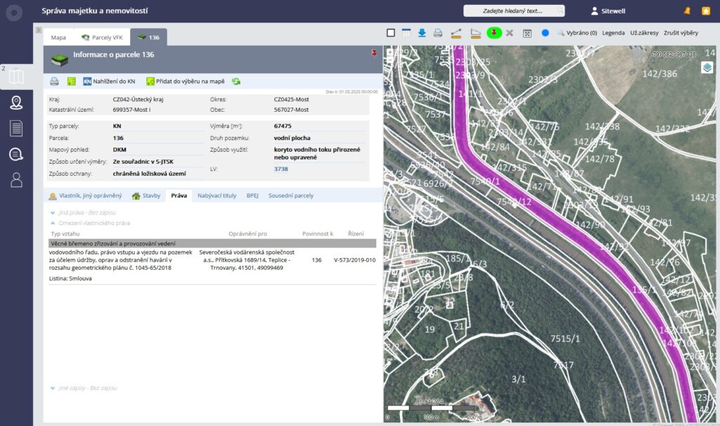
EIRA software enables automatic monitoring of changes in registered parcels and buildings. It alerts users to new ownership relations, easements or changes in geometric and positional determination.
Thanks to this, asset managers and investors can quickly respond to key modifications in the cadastral register.
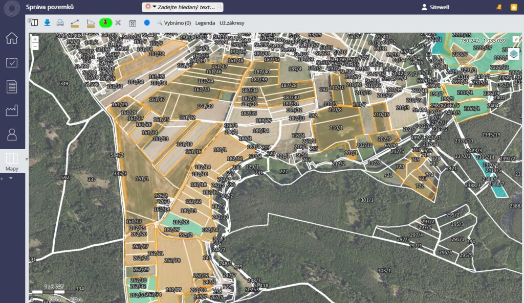
Map Visualization
EIRA software for land registry monitoring enables visualization of cadastral data on a map with the possibility of marking own parcels and buildings, coloring according to the existence of a lease contract or legal restrictions.
Thanks to the integration of public map sources (e.g. LPIS agricultural land register) and own map layers, a comprehensive overview of assets can be obtained in the context of other important information.
Connection with Own Documents
EIRA software for land registry monitoring enables connection of cadastral data with own documentation, which facilitates property management and record-keeping.
Contracts, invoices, technical drawings, photographs or other important documents can be attached to each parcel and building, which are then easily accessible in one place.

Task and Reminder System
EIRA software for land registry monitoring automatically alerts about approaching deadlines, such as regular inspections, revisions, tax due dates or lease contract expirations.
Users always have an overview of upcoming tasks and can take necessary steps in time.
What are the Benefits?
- Simple and intuitive operation: The application is designed so that users can immediately use it without the need for complex training or expert knowledge.
- Operation without installation and licensing restrictions: No need to install any software or purchase expensive licenses. The application is accessible via web browser and allows unlimited number of users.
- Ability to add custom layers: Custom layers for registration and management of inventoried assets ensure personalized approach to data management.
- Access to professional data layers: The application offers integrated layers such as cadastral maps, zoning plans or agricultural land blocks, which provides a comprehensive view of asset management in the context of the surrounding environment.
- Mobility and flexibility: Thanks to internet access, it is possible to work with the application from anywhere, which enables efficient management even in the field.